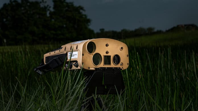
Northrop Grumman has won the initial production and operations contract from the U.S. Marine Corps for the Next Generation Handheld Targeting System (NGHTS). The compact targeting system provides advanced precision targeting and is capable of operation in GPS-denied environments.
The NGHTS is a laser-based device that provides the Marines with an enhanced capability to identify and designate targets from extended ranges. Its advanced technology will significantly enhance warfighters’ ability to safely complete their missions.
Weighing less than 10 pounds (4.5 kg), the system is designed to be lightweight and 60% smaller than previous devices. It combines four systems into one portable device with state-of-the-art imaging, targeting, ranging, designating, and networking.
This compact, multi-sensor electro-optical/infrared device lightens Marines’ loads and keeps them connected while adding precision and safety to their missions. The system performs rapid target acquisition, laser terminal guidance operation, and laser spot imaging functions using its advanced range finder and designator.
With NGHTS, ground forces have the option to call in a target, transmit the precise location or use laser designation, whereas previously, the only option was to call in target coordinates on a field radio. This unique ergonomic handheld product, packed with advanced targeting capabilities, will enable Marines to rapidly acquire and execute guidance against targets and generate target location data during combat operations. In addition, Northrop Grumman designed various parts for NGHTS that can be 3D printed in the field rather than sending them elsewhere for repair.
NGHTS is built around a color day imager, a low-light imager, and a thermal imager for creating images in total darkness. It also features a high-precision GPS receiver and a celestial compass that provides azimuth readings (the angular measurement in a spherical coordinate system) for a target’s heading relative to NGHTS to within fractions of a degree.
The sensors allow NGHTS to provide superior observation from even the most environmentally and physically onerous locations. During twilight, one of the most challenging times of day to see targets, the streamlined Graphical User Interface (GUI) provides a sharp and clear image. It can also handle salt fog, extreme conditions of temperature, vibrations, and the effects of changes in altitude.
