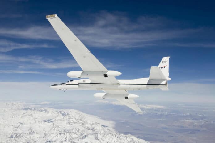
NASA’s high-altitude ER-2 (Earth Resources 2) aircraft began supporting an effort to find and map critical mineral deposits in Western regions of the U.S. Identifying these minerals – often used in everyday products like laptops and cell phones – could help improve environmental processes for mining and geological activities, enhance national security, and boost the economy. This project will continue through Fall 2026.
NASA’s two ER-2 high-altitude civilian atmospheric research fixed-wing aircraft are based on the Lockheed U-2 spy plane that was developed in the 1950s. Suited to perform multiple mission tasks, the ER-2 operates at altitudes from 20,000 feet to 70,000 feet, which is above 99% of the Earth’s atmosphere.
Depending on aircraft weight, the ER-2 reaches an initial cruise altitude of 65,000 feet (18,000 meters) within 20 minutes. It can reach its top cruise speed of 410 knots (759 km/h), has a range of 3,000 nautical miles (5,556 km) for a normal eight-hour mission, and can carry a maximum payload of 2,600 pounds (1,179 kg).
The aircraft have flown over 4,500 missions studying Earth’s atmosphere and related phenomena. They have also been used to test new satellite sensors and study ozone levels.
Currently, one of the ER-2 aircraft is being utilized by NASA for the Geological Earth Mapping Experiment (GEMx) mission since September of this year. The mission is being conducted in collaboration with the United States Geological Survey (USGS) to help locate stores of minerals hidden in the American desert. These minerals are vital for electronics manufacturing, the U.S. economy, and, by extension, national security.
“The U.S. depends on a reliable supply of Earth materials to support its economy and national security,” said Raymond Kokaly, a research geophysicist with the USGS. “Such materials have been deemed critical minerals because disruption of their supply would have significant negative impacts. Undiscovered deposits of at least some of these critical and strategic minerals almost certainly exist in the United States, but modern geophysical data is needed to increase our knowledge of these resources.”
The GEMx mission involves flying NASA’s ER-2 and one of its modified Gulfstream V business jets over the American Southwest, covering states such as California, Nevada, Arizona, and New Mexico. For this mission, the ER-2 is flying over these arid regions at altitudes of approximately 65,000 feet to acquire wide swaths of geophysical data with every overflight.
Researchers mounted instruments on the ER-2 and Gulfstream V to collect measurements. These instruments include NASA’s AVIRIS (Airborne Visible/Infrared Imaging Spectrometer), HyTes (Hyperspectral Thermal Emission Spectrometer), and MASTER (MODIS/ASTER Airborne Simulator).
These instruments collect hyperspectral images that consist of not only visible light but also multiple bands of infrared and thermal radiation. The images allow researchers to see geophysical complexities behind seemingly simple or monochromatic surfaces that might suggest the presence of the critical minerals that are vital for the electronics industry.
Modern geophysical data is exactly what the GEMx project is procuring. This means data that maps not only the constituents of Earth’s surface and atmosphere but also how those constituents change over time between 2023 and 2026.
“If this mission can successfully identify critical minerals in minable locations in the U.S., we could be less dependent on foreign entities for these critical minerals,” said Kevin Reath, NASA deputy program manager for GEMx.
