The widespread adoption of self-driving cars still has a lot of challenges ahead, both technically and legally. When a road is covered with snow or obscured by fog, self-driving cars’ navigation systems may have trouble seeing where that road is.
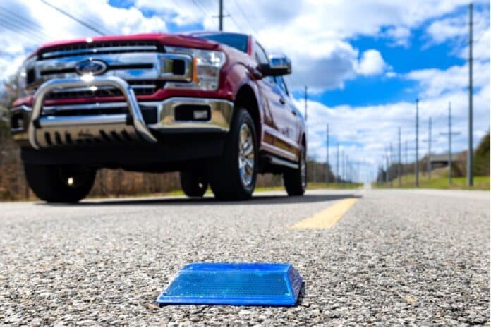
Now, researchers from the Department of Energy’s Oak Ridge National Laboratory and Western Michigan University are working together to drive solutions from outside the car: sensors and processing embedded in road infrastructure. Engineers are placing low-powered sensors in the reflective raised pavement markers that are already used to help drivers identify lanes. The microchip inside the markers transmits information to passing cars about the road shape.
According to researchers, the markers are effective even when vehicle cameras or remote laser sensing called LiDAR are unreliable because of fog, snow, glare, or other obstructions.
Packed inside each road marker unit are a microchip, radio transceiver, battery, and antenna. Engineers utilized a communications protocol that involves hopping across a particular radio frequency spectrum up to 50 times a second. The algorithms developed by the team triangulate among the GPS coordinates of lane markers to reconstruct an image of the drivable area – even if it’s hidden from the vehicle’s view. One algorithm is embedded in a microchip inside the pavement marker, while a decoding algorithm is incorporated into the car’s software.
When field-tested in a variety of weather conditions and in a remote national park in Montana with no wireless access, ORNL researchers found that the sensor platform transmits more than five times beyond the original 100-meter goal. Its battery is estimated to last for the same replacement cycle as the pavement markers, typically a year.
The technology provides more accurate information about the driving environment and also shifts some of the processing load from the car’s software onto the infrastructure. According to researchers, the chip-enabled pavement markers can reduce navigational power consumption by up to 90% when compared to a leading camera and LiDAR-based autonomous driving technology. This saves electric vehicle battery power, extending driving range to promote wider EV adoption.
The marker sensors could eventually convey information about temperature, humidity, and traffic volume. The technology has the potential for use with not only tomorrow’s self-driving vehicles but also today’s common autonomous driving features, such as lane assist.
“We are working to make autonomous driving features accurate and safe in more remote areas,” ORNL researcher Ali Ekti said. “And we are doing it by converting a dummy piece of infrastructure into something with many more uses.”
Journal reference:
- Sachin Sharma, Johan Fanas Rojas, Ali Riza Ekti, Chieh (Ross) Wang, Zachary Asher, Rick Meyer. Vehicle Lateral Offset Estimation Using Infrastructure Information for Reduced Compute Load. SAE Mobilus, 2023; DOI: 10.4271/2023-01-0800
