
Israel-based startup Exodigo has commercially launched its groundbreaking nonintrusive subterranean mapping platform for construction, mining, and utility companies in the United States and Israel. The company claims its software can create 3D maps of underground man-made pipes, cables, soil layers, rocks, minerals, and groundwater.
Alongside the availability of its mapping platform, Exodigo announced $29M seed funding led by Zeev Ventures and 10D Ventures, with participation from SquarePeg Capital and JIBE Ventures.
According to the company, more than $100B is spent every year on unnecessary excavation and drilling to discover what lies underground in an attempt to avoid hitting gas pipelines, water sources, oil, and other potential hazards hidden beneath the surface. These traditional methods are based on heavy tools and equipment that are anything but environmentally friendly. And in addition to being costly, they create avoidable greenhouse gas emissions, waste billions of dollars per year, damage our planet, and cause spills and explosions.
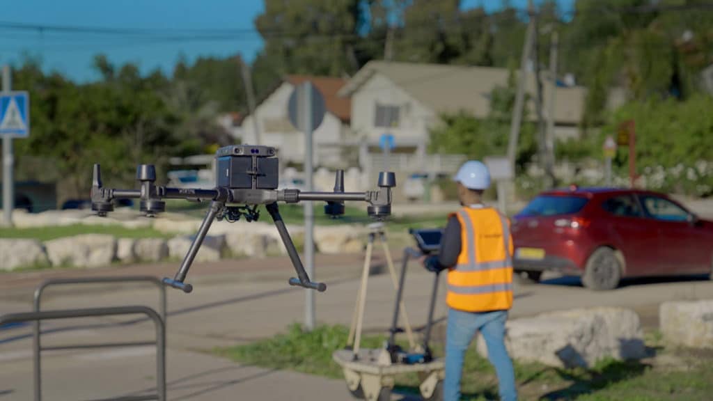
Exodigo proposes a smart, more affordable, safe system carried by drones or small carts. The system uses sensors and artificial intelligence (AI) to effectively provide 3D subsurface imaging, eliminating the need for exploratory excavation, and powers smart drilling and sustainable operations by derisking the discovery process across industries. The technology is non-invasive and risk-free while also providing precise and complete data faster, enabling smart drilling and avoiding unexpected consequences like spills and explosions.
The advanced underground mapping platform can detect buried objects, from man-made pipes and cables to soil layers, rocks, minerals, and even groundwater across any terrain. Exodigo proved its ability to safely and accurately identify underground utilities, abandoned lines, and ground layers in a remote, unmapped area in its first live demonstration.
“It is time to finally break ground on a safer, more sustainable, and infinitely more precise method for subterranean discovery. Our powerful combination of advanced sensor technologies and proprietary AI platform provides users with a safe, fast way to get a complete view of what lies beneath the surface with unprecedented precision,” added Jeremy Suard, co-founder and CEO of Exodigo.
“Ending the era of blind digs, Exodigo gives companies an accurate, easy-to-understand map of what lies beneath the surface – empowering their teams to save time, money, and lives. Think of it like combining the scanning power of an MRI, CT scan, and ultrasound all into one image of what is beneath the ground.”
Exodigo plans to use the funding to accelerate its expansion and start pilot projects in California, Florida, and Texas in the weeks ahead.